Smart Infrastructure
Smart Mobility
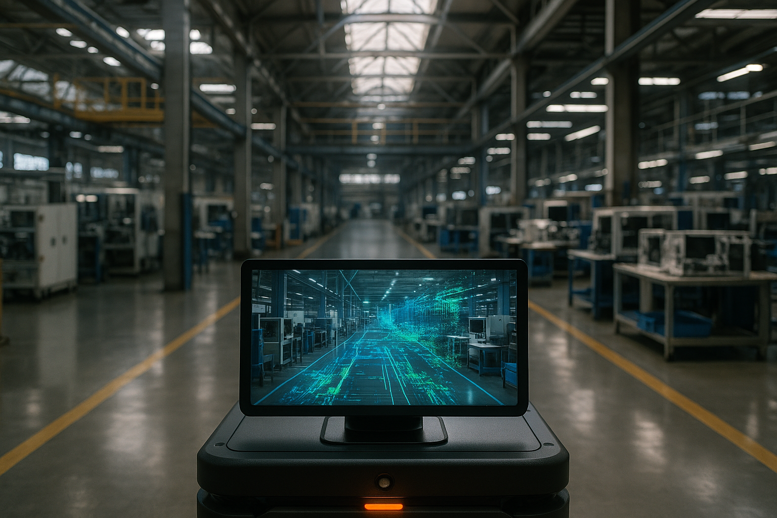
Smart 3D perception
Smart Applications
In the future, infrastructure, mobile vehicles and 3D perception modeling will be fully upgraded
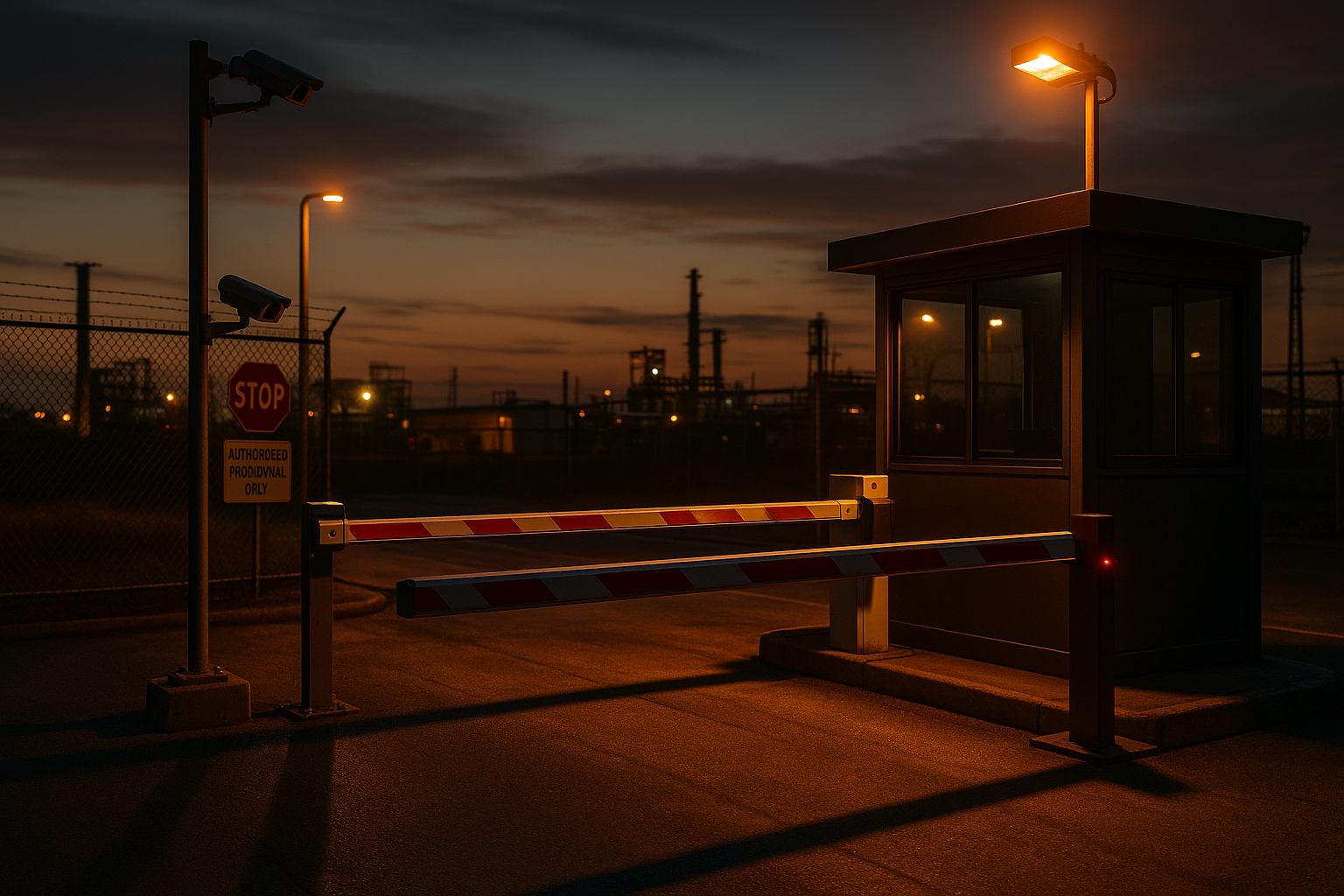
Smart Infrastructure
LiDAR can accurately capture traffic signs, vehicle flow, pedestrian flow, intersections, etc. in the city, helping cities optimize traffic signal logic, analyze dangerous intersections, and further introduce AI algorithms to predict accidents and congestion, creating a true "smart city."
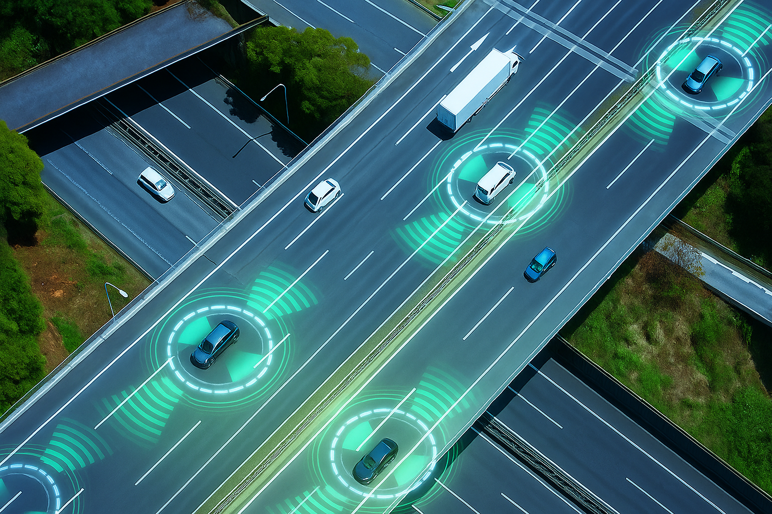
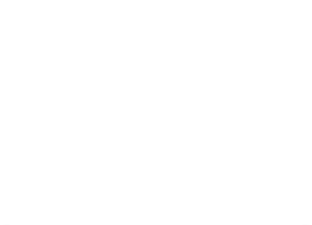
Smart Transportation

Smart Parking
Smart traffic flow

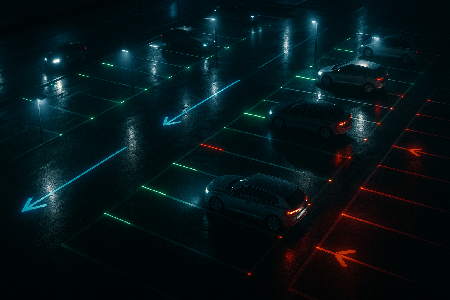
Smart Security
Intelligent Control
Smart Transportation
In the future smart transportation world, safety and efficiency will no longer conflict with each other
Compertum's LiDAR technology is designed for autonomous driving and smart transportation applications
LiDAR can instantly detect pedestrians and vehicles and, in combination with signal control and warning systems, adjust green light times based on intersection traffic flow, detect violations, or alert turning vehicles, effectively preventing accidents and protecting road users.
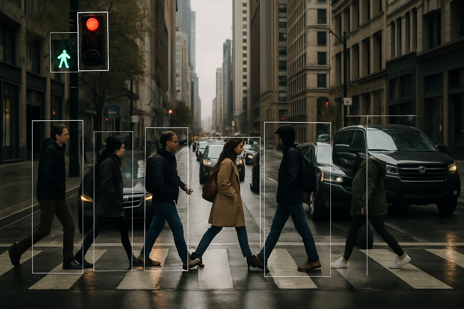
Smart Parking
More accurate identification of object types and dynamic behaviors
Capable of accurately capturing vehicle details in any lighting and weather conditions
LiDAR senses parking space flow and status, instantly reports available parking spaces and guides vehicle routes, allowing parkers to find parking spaces quickly, reducing search time, improving parking lot turnover, and reducing manpower investment.
Smart traffic flow
Ensure the safe and smooth flow of unmanned vehicles
Through high-resolution point cloud data and fusion sensing technology, the system can instantly identify various types of sudden obstacles.
LiDAR can recognize the shapes and movements of people and vehicles, establish virtual fences and warning areas, and automatically remind pedestrians to stay away from forklift routes and restricted access areas, ensuring the safe operation of factories or warehouses and avoiding conflicts between people and vehicles.

Smart Security
Safety at your fingertips, whatever the weather
Compertum's LiDAR can inspect surroundings environment
LiDAR is not affected by other light and can accurately detect people or suspicious objects even at night. It can be used in conjunction with security systems to automatically trigger alarms, improve night patrol efficiency, reduce security costs, and strengthen protection in unmanned areas.
Intelligent Control
Provide continuous and highly reliable situational awareness
Through precise 3D scanning, people and vehicles can be tracked in real time, helping operators manage personnel flow.
LiDAR combined with AI can automatically identify badges, portraits, or ID cards, and is used for access management in factories, parking lots, communities, and other places, improving control efficiency and preventing illegal intrusion.
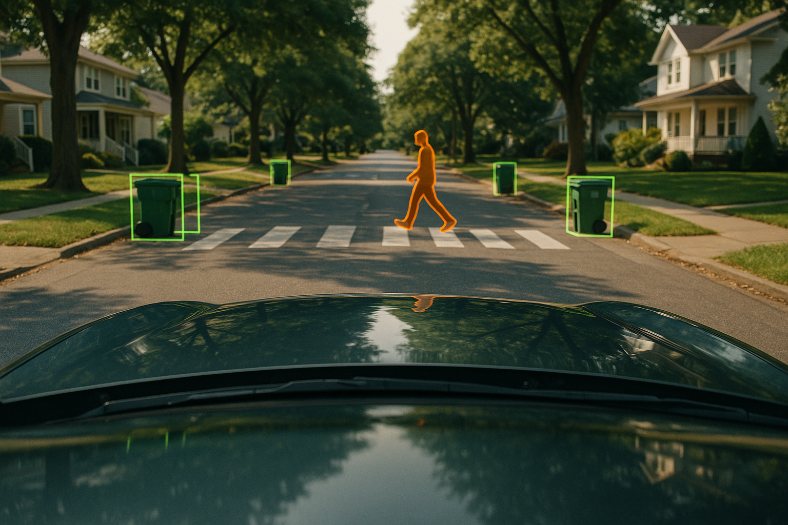
Smart Mobility
Self-driving cars, drones, and unmanned aircraft equipped with lidar can instantly identify the surrounding environment, dynamic objects, and obstacles, and can operate stably even in complex environments, achieving true mobile automation.

Smart Driving
Smart Warehousing

Smart Port
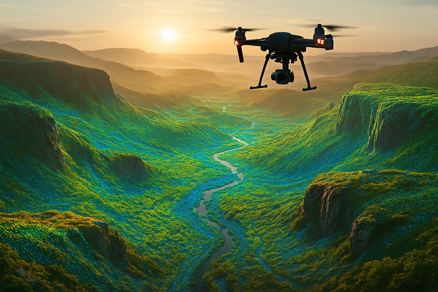
Smart Drones

Smart Public transportation
Smart Driving
Make quick decisions to avoid or slow down based on distance, speed, and direction
Our sensing system can not only clearly capture the outline of objects hundreds of meters away
Long-range, high-resolution lidar systems, combined with imaging and artificial intelligence interpretation, help autonomous vehicles accurately identify man-made obstacles, proactively slow down and steer, and ensure the safety of passengers and pedestrians.
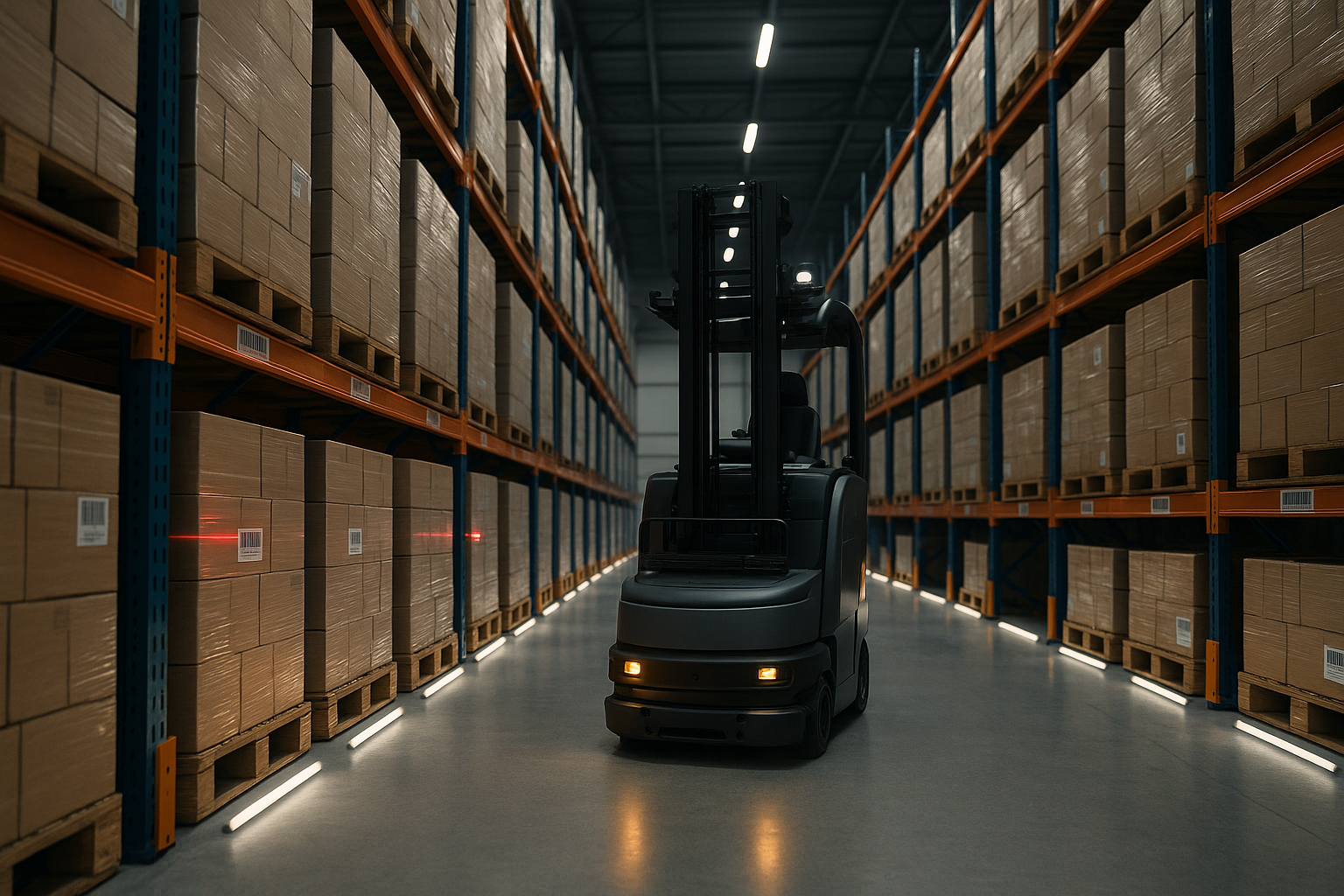
Smart Warehousing
Ensure efficient and error-free operation of logistics systems
In the fields of industrial automation and smart logistics, efficiency and precision are the keys to competition.
LiDAR helps it build instant maps, identify stairs, slopes, obstacles, and moving people, ensuring smooth obstacle avoidance and accurate delivery even in crowded environments.
Smart Port
Easily distinguish products of different sizes and materials
Compertum's LiDAR instantly captures the precise location of every rack, pallet and item within the port.
The combination of LiDAR, IMU, and GPS modules enables autonomous ships to maintain precise positioning and avoid obstacles when navigating near docks and shores, thereby improving port intelligence and operational safety.

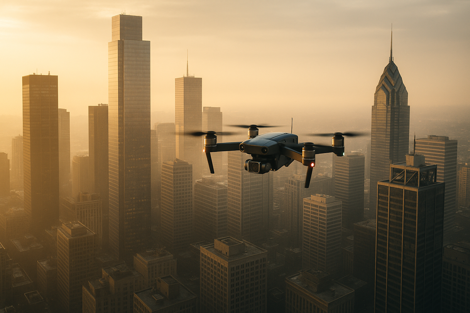
Smart Drones
Making aerial operations smarter and more reliable
Compared with pure image recognition, it provides higher resolution and depth
LiDAR can be used for aerial terrain modeling, building scanning, and power tower inspections, and is particularly useful in environments such as forests, river valleys, and power lines where visual identification is difficult.
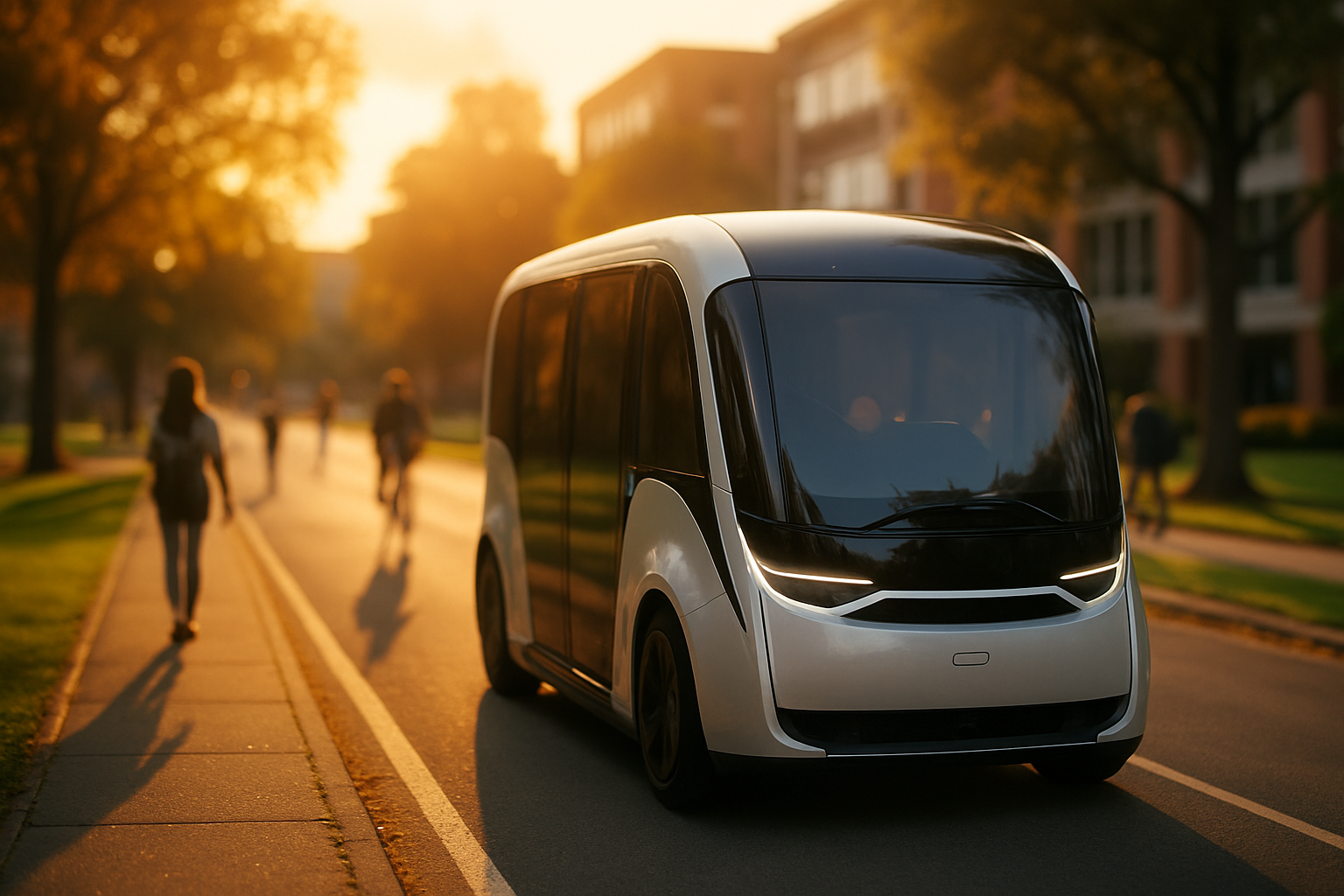
Smart Public transportation
Seamless integration into smart traffic signs and traffic monitoring platforms
Compertum's LiDAR is optimized for traffic systems
Whether on campus, at airports, or in city centers, smart shuttles are becoming increasingly popular. These shuttles utilize comprehensive perception systems powered by lidar to enable intelligent dispatching, reduce waiting times, and improve commuting efficiency.
Smart 3D perception
High-precision point cloud data can construct a 3D model of the environment and achieve real-time positioning. Whether it is SLAM, terrain mapping, smart building monitoring, or indoor robot navigation, the 3D perception capabilities provided by LiDAR are the core foundation of automation.

SLAM positioning

3D environment modeling
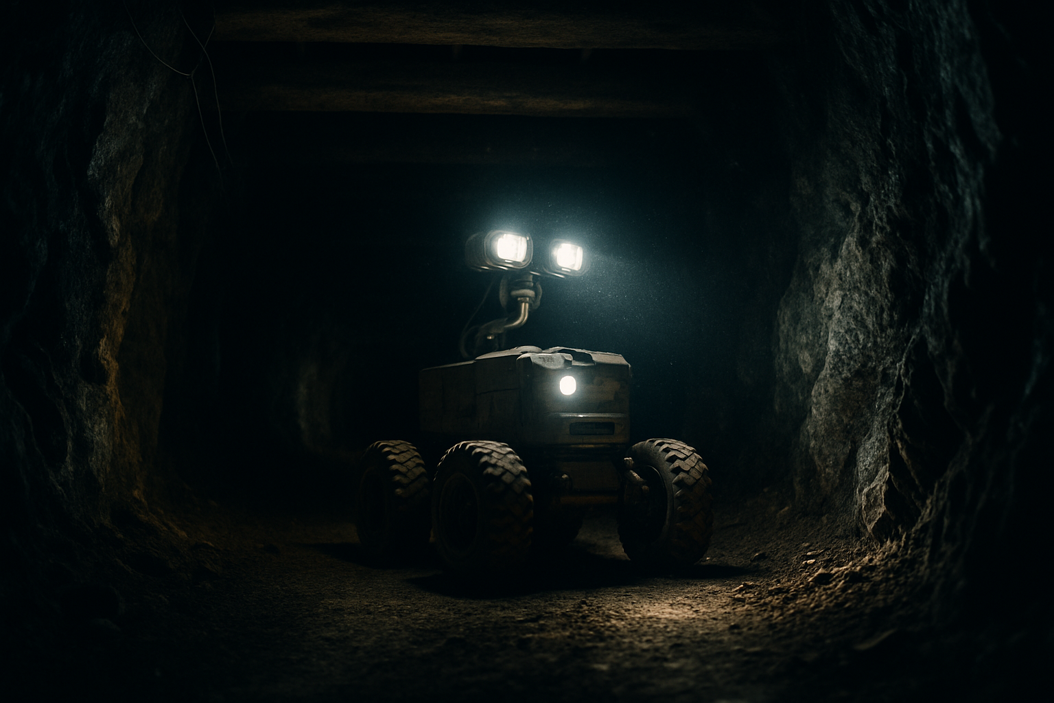
Exploring harsh environments

Construction monitoring
Exterior wall and electrical wiring inspection
SLAM positioning
SLAM technology is the core of autonomous operation of unmanned systems
Provides extremely stable and accurate input data for SLAM (Simultaneous Localization and Mapping) systems
Mobile platforms equipped with lidar (such as autonomous mobile robots and drones) can use SLAM technology to simultaneously build maps while moving. This is particularly important in environments without GPS signals, such as indoors or underground.
3D environment modeling
Generate detailed environment models using high-density point clouds
Compertum's LiDAR technology is capable of capturing 3D data at high speed and high precision.
LiDAR can be used to create high-density 3D point clouds to reconstruct spaces such as buildings, tunnels, factories, and natural terrain. These models can be integrated into Building Information Modeling (BIM) systems.
Exploring harsh environments
Improve high precision and anti-interference capabilities
Compertum's lidar can maintain stable operation even in rain, snow, fog or low light conditions.
Leveraging the powerful depth perception capabilities of laser radar, robots can carry lidar to explore extreme environments such as earthquake sites, border patrols, underground pipelines, and harsh terrain, achieving autonomous navigation and high-precision map creation.
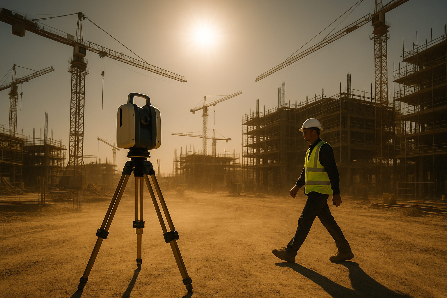
Construction monitoring
Safety and efficiency are no longer in conflict
Compertum hopes to establish a tighter and smarter security line through advanced sensing technology
LiDAR can quickly scan a site and compare it with the original design model, helping to track project progress and verify construction errors and material deformation. This technology is also widely used in old building renovation, underground facility modeling, and bridge health monitoring.
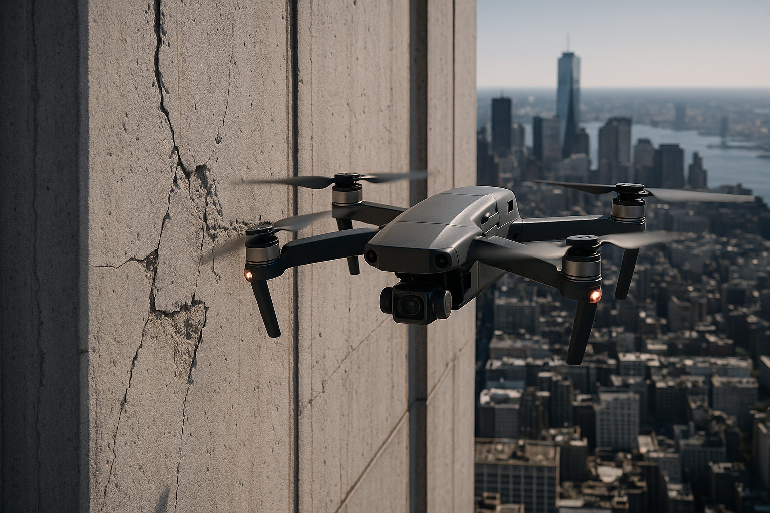
Wall and wire inspection
Assist in post-disaster reconstruction, infrastructure detection, etc.
Through high-precision point cloud data, the system can realize micro-deformation monitoring and structural analysis.
Using lidar to scan the exterior walls of large buildings allows for regular comparison of structural changes. It can also be used in conjunction with drones to detect defects in high-voltage power lines, improving inspection efficiency and personnel safety.