EN
120° high-resolution long-distance LiDAR

T3

120° high-resolution long-distance LiDAR

T3 - A new generation of flagship LiDAR leading the way in intelligent perception

Compertum's new high-resolution, long-range products usher in a new era of intelligent sensing

The T3 LiDAR is Compertum's flagship intelligent perception solution, designed for automotive, autonomous driving, and advanced intelligence applications.
It integrates high-resolution laser sensing, AI camera recognition, 3D point cloud optimization, and image fusion algorithms to deliver 800 lines of high resolution, an ultra-long range of 150 meters, and 1.5 million points per second of imaging capability. It also supports RGB point cloud and AI frame recognition, enabling the system to not only "see" but also "read" the environment, setting a new benchmark for lidar performance.
T3 core technology
150 m
1,536,000 p/s
L:175 W:153 H:51
LFOV: 120° X 25°
CFOV: 120° X 75°
H:0.13° X V:0.15°
Maximum distance(10% @100kLux)
High-definition points(point/second)
Small size(mm)
LiDAR field of view
Camera field of view
Angular resolution
Innovation in Smart Sensing Architecture, Opening a new era of perception
The T3 LiDAR is equipped with a SPAD-SoC chip and a high-power VCSEL laser, with built-in digital signal processing and noise suppression functions to ensure that the output point cloud data is complete, clear, and highly accurate.
The camera module integrates an AI model to achieve millisecond synchronization between images and point clouds, realize AI fusion perception, and provide a strong perception foundation for autonomous driving and smart cities.
T3 laser radar installed on board
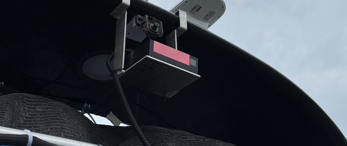
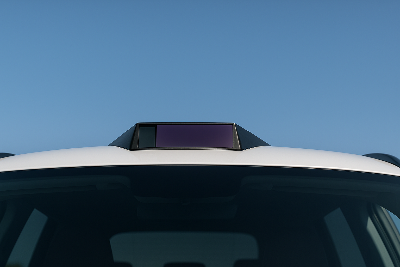
High-definition 3D sensing capability Flexible embedding in various applications

✨ Long distance and high sensitivity

It can detect dark targets with a reflectivity of 10% within a distance of 150 meters and maintain stable performance at night, in rain, fog or low visibility environments.

✨ High resolution and high density

With 800 lines of resolution and 1.5 million output points per second, it can accurately reproduce small distant objects such as pyramids, cardboard boxes, and even electrical wires.

✨ Wide field of view

With a horizontal range of 120° and a vertical range of 25°, it covers a wide range of scenarios and is suitable for panoramic road scanning, warehouse monitoring, industrial detection, etc.

✨ High-precision angular resolution

Its horizontal accuracy is 0.15° and vertical accuracy is 0.13°. It can accurately depict the boundaries of tiny objects and provide a more reliable basis for safety decision-making.

🚗 Autonomous driving and smart transportation

High-speed perception of vehicles, pedestrians, bicycles and road facilities enhances the real-time decision-making capabilities of smart transportation.

🏭 Industrial Automation and Logistics

Accurately track goods, people, and machinery to support efficient operations in warehouses, ports, and factories.

🛸 Drone modeling

The small design can be easily embedded in drones to generate high-precision SLAM maps for measurement, detection, disaster monitoring, etc.

🏙 Smart city monitoring

It is installed on smart light poles or roadside devices to monitor traffic flow, crowd distribution and security events.

🤖 Service and inspection robots

AI recognition boxes and RGB point clouds enable robots to perform obstacle avoidance, navigation, and human-computer interaction more intelligently.

RGB point cloud and AI recognition box — The perfect combination of three-dimensionality and wisdom

🔹 RGB point cloud reconstruction

The point cloud distance information is deeply integrated with the camera's color image to produce an intuitive true-color 3D model, making the system more interpretable in terms of navigation, monitoring, and modeling.

🔹 AI recognition frame technology

Vehicles, pedestrians, traffic cones, and various obstacles are instantly marked in the point cloud, achieving semantic-level perception. This makes lidar no longer just a "distance sensor," but the eyes of intelligent decision-making.

🔹 Point cloud algorithm upgrade

The built-in Compertum intelligent point cloud engine effectively eliminates noise and identifies the nearest obstacles, reducing false alarms and improving reliability in any scenario.

Single device integration, multi-modal perception

T3 supports the Camera+LiDAR dual-sensing architecture, which can synchronize two data sources in milliseconds and supports AI functions such as SLAM, semantic segmentation, mapping, and obstacle avoidance.
It can be quickly integrated into mainstream process architectures such as ROS and NVIDIA Jetson to accelerate the implementation of various applications.

T3 LiDAR installed on the top of the car
T3 C-LiDAR — Creating a new vision of intelligent perception
Compertum believes that LiDAR is not just a sensor, but also the core foundation of smart applications.
Through T3, we deeply combine high-resolution laser sensing with AI fusion algorithms, allowing smart machines to not only "see" the world, but also "read" the world.
Compertum T3 C-LiDAR — Fusion drives the future and defines the next generation of intelligent perception.
Buy Now Specifications